GeoDLL
This programme is presented to you by:
Postfach 400225
47896 Kempen
Deutschland / Germany
| E-mail: | info [at] killetsoft [dot] de |
| Phone: | ++49 (0)2152 961127 |
| Facsimile: | ++49 (0)2152 961128 |
| Website: | www.killetsoft.de |
| Category: | Development / Components & Libraries |
| Version: | 17.28 |
| Release date: | 2017-08-24 |
| Size: | 4.41 MB |
| OS: | Win 2000 / XP / 2003 / Vista |
| Requirements: | Pentium, 20 MB free Disk |
| Languages: | German, English |
| Downloads: | 0 in May / 34 in total |
Rating: 2.14/10 (7 votes cast)
| Download: | http://www.killetsoft.de/zip/geodll.zip |
| Infopage: | http://www.killetsoft.de/p_gdla_e.htm |
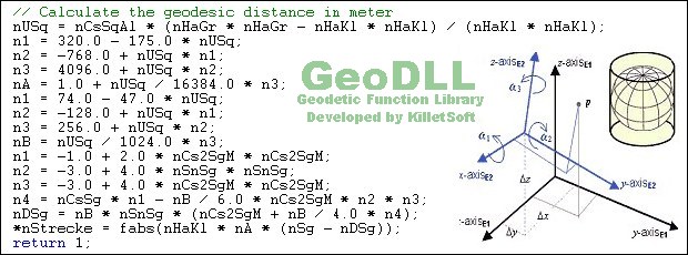
GeoDLL supports the development of geodetic software on various platforms by providing geodetic functions. GeoDLL contains precise calculations on the themes 2D and 3D coordinate transformation, geodetic datum shift and reference system converting, meridian strip changing, user defined coordinate and reference systems, distance calculations, Digital Elevation Model, NTv2 handling and BeTA2007 support, Direct / Inverse solutions, map function and geodetic converting functions. The most important application of GeoDLL is to include professional coordinate transformations in own programs. These coordinate and reference systems are supported: 1. The current and many historical coordinate and reference systems of all countries of the European Union (EU) including the eastern extensions and the systems of the European non-EU countries. 2. The European ETRS89 systems forced by INSPIRE with respect to the continental drift. 3 .The US and Canadian State Plane Coordinate Systems (SPCS) and other systems of the North American continent. 4. Many coordinate and reference systems of the countries of all continents and the world-wide used coordinate and reference systems. 5. World-wide NTv2 grid file supported coordinate transformations. 6. The coordinate and reference systems of the old and new German Federal States, the 40 Prussian Soldner Land Registers, the German 'Lagestatus', special reference systems of the German Federal States and BeTA2007. 7. User defined coordinate systems, reference systems and earth ellipsoids. GeoDLL comes with extensive documentation and is supplied as DLL file or as C++ source code for 32bit and 64bit architectures. The DLL works with most programming languages and it can be used with Microsoft Office programs. The DLL is written in C++ and was developed with Microsoft Visual Studio 2010. Thus very fast performance, compact code and high stability are assured. The functions of GeoDLL are prepared for multithreading.
Here you can subscribe for the update infos for this programme. You will then receive an e-mail notice each time an update has been submitted for this programme.
In order to subscribe for the update infos, please enter your e-mail address below. You will then receive an e-mail with a link, which you need to click in order to confirm you subscription.
You can unsubscribe from the list at any time. For this purpose, you will find a link at the end of each update info e-mail.
This service is completely free of charge for you.